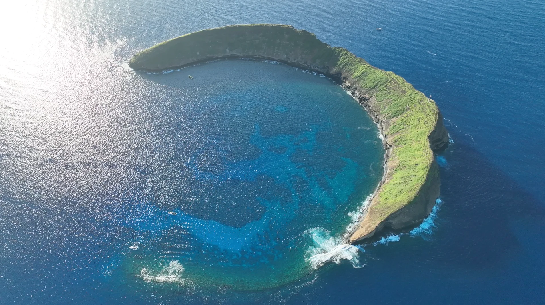
Six connected ways to explore the crater, from its living reef to the stories and stewardship that surround it. Choose a numbered marker or a topic below.
Illustrative habitat markers · Archive photograph
Markers introduce broad topics. Use official charts and rule maps for navigation and legal boundaries. Photograph capture date was not supplied.
Inside the crescent
The protected waters and reef inside Molokini’s crescent are one part of a much larger living system. The 2009 mooring guide describes Enenue and Mid Reef as distinct inner-crater areas; these are historical site descriptions, not current condition reports.
Look for the relationship between shallow reef and deeper water.
Fish counts depend on habitat, depth, time and survey method.
Read the current MLCD rules before interpreting old guidebook advice.
Corals belong in an animal atlas. The reef also supports small crustaceans, mollusks, echinoderms and other organisms that a quick snorkel can overlook. The catalogue preserves records resolved only to genus or family rather than assigning them invented species names.
Explore corals alongside other reef invertebrates.
A historical presence record does not establish today’s population.
Compare repeated surveys only after checking their methods.
Molokini’s outer rim and Back Wall face different exposure from the inner cove. The 2007 Bishop Museum survey documented animals along the southeast outer rim; its findings should not be mistaken for a census of every crater habitat.
Outer-rim records include a surveyed depth range of 4–28 metres.
The 2009 guide describes Reef’s End and the Back Wall separately.
This learning map is not a dive plan or navigational chart.
The dry land and the surrounding marine district have different protections. Molokini’s islet is a state seabird sanctuary. Its birds and native plants are part of the conservation story, even when the camera’s attention is on boats and water.
Enjoy the islet from the water.
Do not infer nesting success from birds visible in an aerial photograph.
Use official sanctuary information for access restrictions.
Physical reef contact, underwater sound, animal disturbance and preventable pollution need their own evidence. A visible boat count helps describe activity; it cannot by itself measure ecological damage or identify a violation.
Anchor and chain damage is documented in historical field research.
Current rules prohibit anchoring throughout the MLCD.
A quieter, cleaner visit begins with deliberate operating practices.
The stories connect Molokini to places across Maui and beyond. The reference library follows those relationships through recorded accounts of Pele, Puʻuoinaina, Puʻulaina and Kana, while preserving the differences between their narratives.
Read each moʻolelo with its named published source.
Keep geological evidence and traditional accounts distinct.
Explore South Maui and Kahoʻolawe through the connected reading pages.